Summary
This project utilizes Python, API’s, and JSON to try and answer a fundamental question: “What’s the weather like as we get closer to the equator?” Click here to see the Weather Project.
I randomly assigned 1,500 Latitude and Longitudes, then used the Python CitiPy library to find the city closest to the Lat/Lon (dropping all duplicates) to get a listing of 606 cities. I utilized OpenWeatherMapAPI to get the weather for the cities (dropping cities with no data) to create a dataframe of weather information for over 500 cities.
The data is saved to CSV and the data is analyzed to showcase the relationship between latitude and temperature/humidity/cloudiness/wind speed. I then used MatplotLib scatter plots to view:
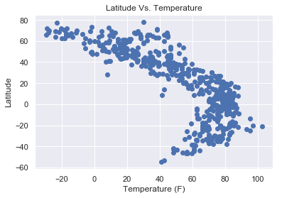
- Latitude vs. Temperature (F)
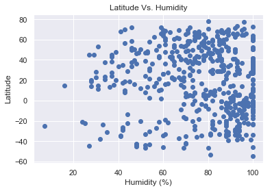
- Latitude vs. Humidity (%)
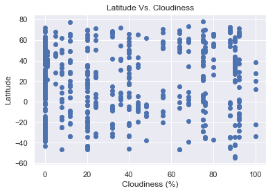
- Latitude vs. Cloudiness (%)
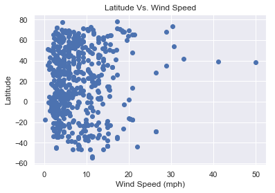
- Latitude vs. Wind Speed (mph)
Visualizations